Control your antenna rotators straight from N1MM Logger+ broadcasts — with a live map, compass, VOACAP propagation overlay and Maidenhead grid. On Windows and Android, with dark mode.
Control your antenna rotators straight from N1MM Logger+ broadcasts — with a live map, compass, VOACAP propagation overlay and Maidenhead grid. On Windows and Android, with dark mode.
The same rotor control on your desktop and your phone.
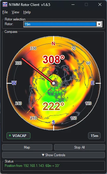
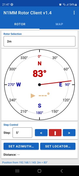
Everything you need to point the beam, without leaving the shack.
Listens for N1MM Logger+ rotor UDP broadcasts on your network and detects every advertised rotor automatically.
Pick a rotor, enter an azimuth and hit Go, step left/right, or Stop All — commands are sent straight back over UDP.
A live map shows your home station, a blue heading line along the current azimuth and a red great-circle path to any point you click.
Enter a Maidenhead locator or click the map to read bearing and distance instantly — in kilometres or miles.
Set the heading-line length to anything up to the Earth's full circumference (40 075 km) — from both apps.
Toggle a Maidenhead grid from fields down to sub-squares, drawn at the right density for every zoom level.
The live VOACAP coverage map for the antenna's band, drawn right under the compass — see which directions are open before you turn. Band chip to switch bands on multi-band antennas. (Requires N1MM Rotor Server v2.15+.)
The Windows client listens to N1MM Logger+'s radio broadcasts and automatically selects the rotor — and overlay band — for the band you're on.
Day/night terminator with a twilight gradient on the map view, refreshed every minute — ideal for greyline DX.
Switchable dark mode on both platforms. On Windows also Compact and Heading-only views — from full control panel down to a tiny always-visible heading readout.
When N1MM Rotor Server parks the antennas in a storm, the client shows a flashing "STORM MODE ACTIVE!" warning.
The Windows client can check this website for a new version at startup — or on demand via Help → Check for Updates.
Native on the desktop, native in your pocket.
The same rotor selection, azimuth control and map view on both platforms.
Three steps to point the antenna.
Enter your Maidenhead locator once in Settings. The map centres on your station and draws the heading line from there.
N1MM Logger+ broadcasts your rotors on the network (port 13010 by default). The client picks them up and lists them.
Type an azimuth, click the map or double-click a destination — the rotor command goes straight back to N1MM.
What changed, per release.